


Apuan Alps in northern Tuscany
Content
The Apuan Alps (Alpi Apuane) are the rugged limestone and marble mountain range in northwestern Tuscany, between the Versilia coast and the Garfagnana region. The peaks rise to almost 2.000 meters just a few kilometers from the sea. Hikers will find alpine tours with sea views, as well as caves and the world-famous Carrara marble quarries.
Apuan Alps – at a glance
- Location: between Magra (northwest), Serchio/Garfagnana (east) and the coast of Versilia and Riviera Apuana (southwest); provinces of Massa-Carrara and Lucca
- Highest mountain: Monte Pisanino, 1.946 m
- Protected area: Alpi Apuane Regional Nature Park (since 1985), UNESCO Geopark since 2012
- Caves: Wind cave (all year round, guided tours of 1 to 3 hours) and Corchia cave (largest cave system in Italy)
- Marble: Quarries near Carrara, for example by Jeep tour through the Carrara marble quarries (GetYourGuide)
- Best time for hiking: May to October; in winter there is often snow on the peaks.
The mountains and the nature park
The Apuan Alps have no geological connection to the "real" Alps – they belong to the Apennine foothills, but with their steep ridges and cirques, they appear high alpine. The name derives from the Apuans, a Ligurian tribe who lived here in antiquity. The mountain range is heavily karstified: almost 2.000 caves are known.
Since 1985, the Apuan Alps Regional Natural Park has protected a large part of the mountain range. In 1997, the area was reduced to approximately 20.600 hectares to allow marble quarrying to continue – a conflict that still shapes the region today. Since 2012, the park has been part of the UNESCO Global Geoparks Network.
The highest peaks
| Summit | Height |
|---|---|
| Mount Pisanino | 1.946 m |
| Rosskopf | 1.895 m |
| Mount Tambura | 1.895 m |
| Pania of the Cross | 1.858 m |
| Monte Grondilice | 1.808 m |

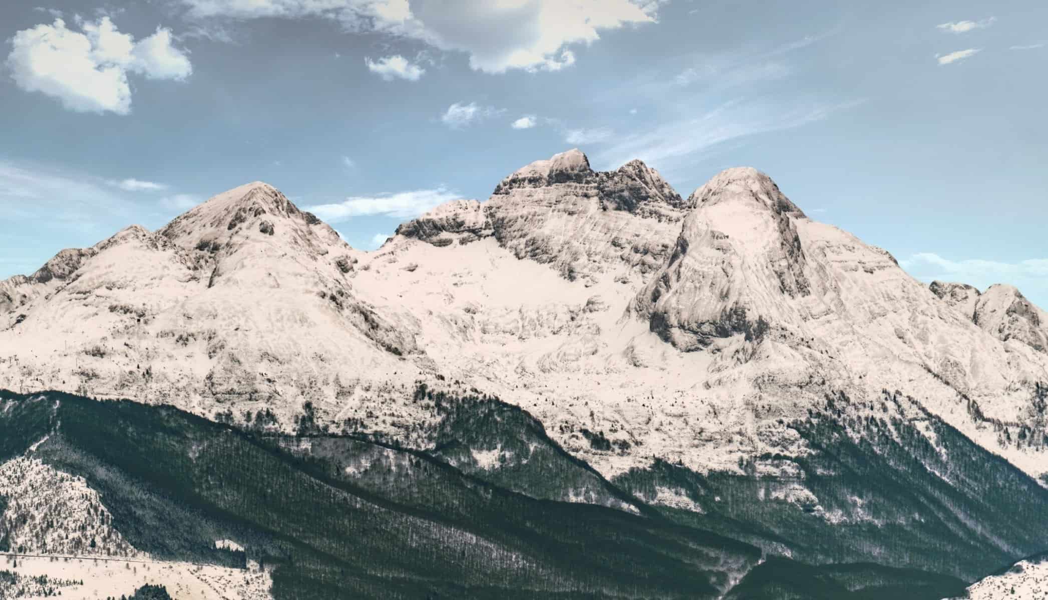
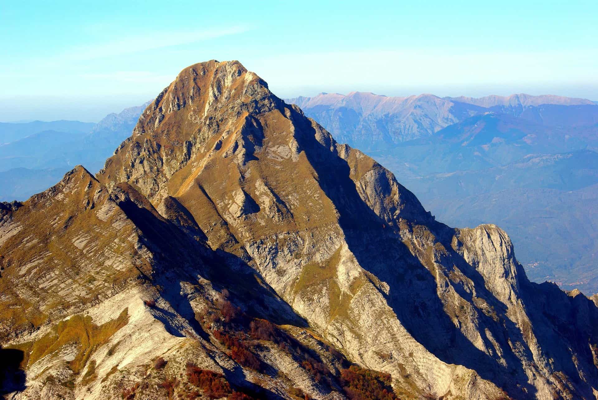
Monte Cavallo 1.895 m 
Monte Pisanino 1.946 m Monte Tambura 1.895 m

Hiking in the Apuan Alps
The network of trails is dense and marked with the red and white blazes of the CAI (Club Alpino Italiano). Many hikes are challenging despite their relatively low altitude: steep, often exposed paths, scree, and marble gravel. Fog rolling in from the sea is a common hazard, as it can quickly make navigation difficult. Be sure to bring sturdy footwear, plenty of water (springs are rare), and a map or GPS track. For more ideas, see our article Hiking in Tuscany.
Pania of the Cross
Pania della Croce (1.858 m) is considered the "Queen of the Apuan Alps". The ascent leads through beech forests and across scree slopes; on clear days, the view from the summit stretches across the Ligurian and Tyrrhenian Seas to the Apennines. The hike is long and requires sure-footedness.
Monte Forato and the double sunset
Zwischen den beiden Gipfeln des Monte Forato spannt sich ein großer natürlicher Felsbogen. Er sorgt für ein bekanntes Schauspiel: Um den 29. November bis 1. Dezember verschwindet die Sonne vom Serchio-Tal aus gesehen am Nachmittag hinter dem Bogen und taucht Sekunden später im Loch wieder auf – ein „doppelter Sonnenuntergang“. Laut Grotta del Vento ist er gegen 15.30 Uhr zu sehen, ein guter Beobachtungspunkt liegt beim Weiler Trimpello an der Straße nach Vergemoli.
Campocatino and Monte Roccandigia
The hike near Vagli Sotto is easier: The alpine village of Campocatino lies at around 1.000 meters in a former glacial cirque with old shepherds' huts, above which rise the rock faces of Monte Roccandigia. Nearby is the Vagli reservoir with the submerged village of Fabbriche di Careggine.

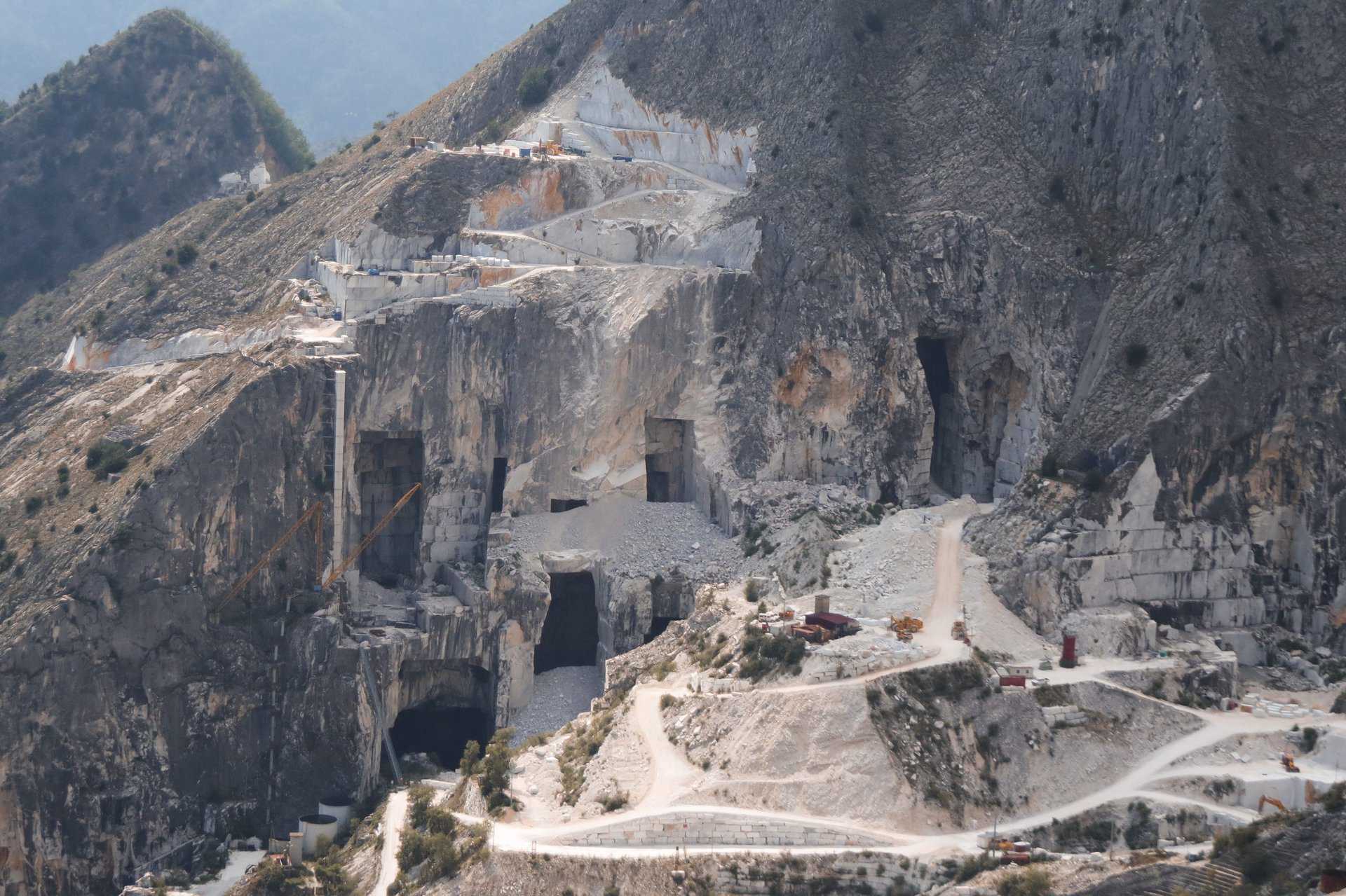
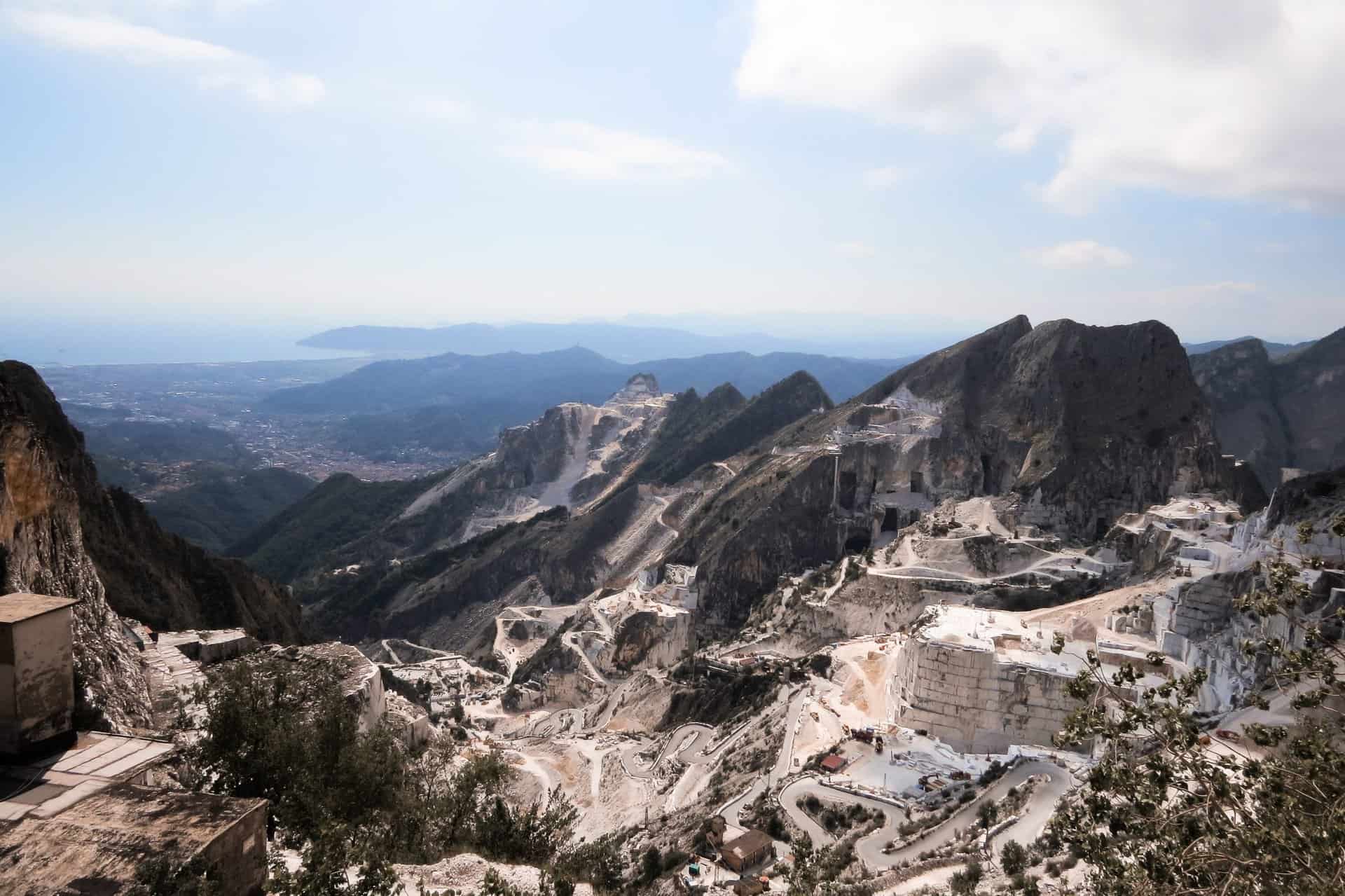
Marble quarry near Carrara Marble quarry near Carrara
Huts and starting points
For multi-day hikes, there are mountain huts (rifugi) run by the Italian Alpine Club (CAI) and private operators. Many are only open continuously during the summer; otherwise, they are open on weekends or by request – reservations are recommended. Good starting points are the mountain villages of Versilia, such as Stazzema, Cardoso, Pomezzana, and Levigliani, as well as Fornovolasco, Vagli, and Castelnuovo di Garfagnana on the Garfagnana side. The best times for hiking are May/June and September/October, when the chestnut forests are in full color; start early in the summer.
Caves and marble quarries
Wind cave
Die Grotta del Vento bei Fornovolasco (Gemeinde Fabbriche di Vergemoli) auf der Garfagnana-Seite ist ganzjährig geöffnet (außer am 25. Dezember). Es gibt drei geführte Routen: 800 m in etwa 1 Stunde, 1.500 m in 2 Stunden und 2.200 m in 3 Stunden mit Tropfsteinen, kleinen Seen und unterirdischen Wasserläufen. Drinnen hat es konstant 10,7 °C – Jacke mitnehmen. Aktuelle Zeiten und Preise sowie die Online-Buchung finden Sie auf der offiziellen Website.
Corchia cave
The Antro del Corchia in Monte Corchia, with approximately 70 kilometers of passages and shafts, is the largest underground cave system in Italy. Visitors can explore about 2 kilometers of it on a guided tour. A shuttle bus takes you from the village square in Levigliani di Stazzema to the entrance at an altitude of around 860 meters. For tour dates and prices, contact the operator, Corchia Park.
The marble quarries of Carrara
Bright white quarries dot the slopes above Carrara ; around 100 of the approximately 140 active quarries in the Apuan Alps lie within the Carrara basin. The quarries near Colonnata, Fantiscritti, and Torano can be visited, most conveniently with a guided tour – such as the Jeep tour through the Carrara marble quarries or a full-day tour entitled "Carrara Marble of Michelangelo ." Marble is also used in the sculpture workshops of Pietrasanta.
Lodging
For hiking on the eastern side, the Garfagnana region is ideal: accommodations in Castelnuovo di Garfagnana can be found on Booking.com . Those who want to combine mountains and sea can stay on the coast in Versilia, for example in Forte dei Marmi or Viareggio , and then head into the mountains for excursions.
Find accommodation in the Garfagnana
Excursion destinations on the edge of the Apuan Alps
Nestled between the mountains and the sea near Viareggio lies Lake Massaciuccoli, a nature reserve with reed beds and diverse birdlife; Giacomo Puccini lived on its shore in Torre del Lago. To the south lies Lucca with its walkable city walls. Read more about the coast between Carrara and Pisa in Tuscany Coast from Carrara to Pisa.

Frequently asked questions about the Apuan Alps
What is the highest mountain in the Apuan Alps?
Monte Pisanino, at 1.946 meters, is the highest peak (some sources cite 1.947 m). It is followed by Monte Cavallo and Monte Tambura, each at approximately 1.895 meters.
Where are the Apuan Alps located?
In northwestern Tuscany, in the provinces of Massa-Carrara and Lucca, between the Versilia coast and the Garfagnana. They are bordered by the Magra and Serchio rivers.
Is the Apuan Alps a good place for hiking?
Yes, there is a dense network of trails marked by the CAI (Italian Alpine Club). Many tours are steep and sometimes exposed; sure-footedness, good footwear and water are essential, and fog can roll in quickly.
Which caves can you visit in the Apuan Alps?
The Grotta del Vento near Fornovolasco (three guided tours of 1 to 3 hours, all year round) and the Antro del Corchia near Levigliani, the largest cave system in Italy with around 2 km of visitor path.
When is the double sunset at Monte Forato?
Laut Grotta del Vento um den 29. November bis 1. Dezember, gegen 15.30 Uhr, gut zu sehen bei Trimpello im Serchio-Tal.
Are the Apuan Alps a national park?
No, they are a regional nature park (Parco Naturale Regionale delle Alpi Apuane, founded in 1985) and a UNESCO Geopark since 2012.


